Gianfranco Adornato, Francesca D’Andrea
September 14, 2021
University of Durham (online conference)
The City’s Shape. Making a Verbo-visual Lexicon of the Ancient Rome
Abstract: The Department of Excellence of the Faculty of Humanities at the Scuola Normale Superiore in Pisa
has developed a multidisciplinary scheme for the study of the relationship between the text and the image. Among several approaches, our project aims to explore the ancient city of Rome, by developing a GIS to collect literary, epigraphic, archaeological and iconographic sources. This tool makes it possible to digitise the archaeological documentation and to create many relations with literary sources and authors, artworks and artists, by creating spatial and non-spatial layers. The creation of an art-historical and literary GIS will bring texts and artworks back into the urban landscape to which they belonged. This will enable to fill monuments and contexts with the descriptions given by the writers who witnessed the arrival and the exhibition in Rome of hundreds of sculptures and paintings from the Greek world. Thanks to this multidisciplinary approach, the project intends to create a digital lexicon enriched by words and images, in order to provide scholars (and not only) a fascinating learning experience of the ancient Rome.
With this paper the Oltreplinio Project will take part in the conference “Digital Italy 2021”, organized by the University of Durham.
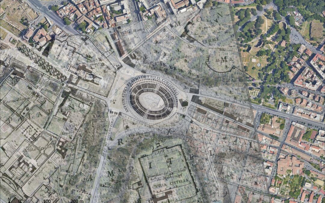
Credits: G.B. Nolli’s plan of Rome (1748) geo-referenced using the Software open source QGIS and overlapped to the satellite map (Elab. D’Andrea)